60 Years of Gerrymandering
A regular refrain in discussions of gerrymandering and redistricting reform is “this has been going on for hundreds of years, so why does this matter now?”
New mapping technologies and data-mining capabilities have made it possible for map-makers to select voting blocks with great precision.
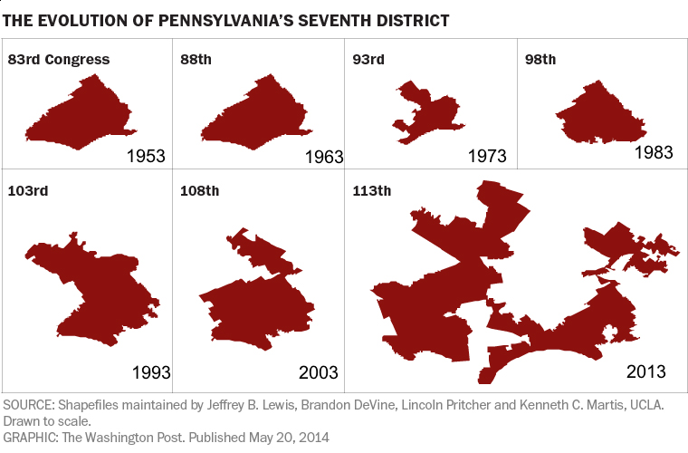
In 2014 the Washington Post published an article, What 60 years of gerrymandering looks like, demonstrating the increasingly contorted districts in areas with a mix of voters. Pennsylvania’s Congressional Districts 7 is one of those districts, carving up small urban communities and diluting their voice by reaching into surrounding farmland and wealthy suburban areas. The maps above are from that article, with dates added to make the point more clear.
The article concludes, “What’s at stake, after all, is citizens’ representation in Congress. Partisan gerrymandering undermines the whole notion of a representative government.”
You can check the evolution of your own districts—Congressional and legislative—on the PA redistricting website.